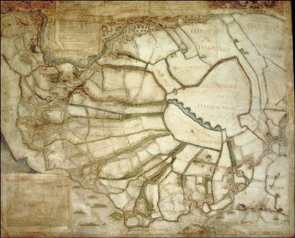
Plan of the Seven Marshland Townships. One of the earliest known large-scale local English maps drawn to a stated scale. The map, which depicts King's Lynn and Wisbech, is the earliest surviving measured map of this region.
More information
Title of artwork, date
Plan of the Seven Marshland Townships, 1582
Date supported
1992
Medium and material
Ink & colours on parchment
Dimensions
69 x 83 cm
Grant
3500
Total cost
14000
Content note: This object record is part of our archive and has not been updated since it was first published. It may contain inaccurate information or outdated language. Please get in touch if you think this record should be amended.

Get a National Art Pass and explore British Library
You'll see more art and your membership will help museums across the UK
National Art Pass offers available at British Library
50% off exhibitions
Art Funded by you FAQs
Contact us
If you have a question about a work of art in our archive, please contact the Programmes team. We’ll be happy to answer your enquiry.